The Far West
Eight days in Iceland's Wild West: Snæfellsnes and the Westfjords
Act One / Snæfellsnes Peninsula
Most people who go to Iceland drive the Ring Road. You stay on Route 1, do the Golden Circle, see Seljalandsfoss and Skógafoss, hit the glacier lagoon, maybe push east to Jökulsárlón. It is a beautiful loop and there is nothing wrong with it. We had done this, as well as the entire ring road on our last trips to Iceland.
Snæfellsnes, just north of Reykjavik, juts out from the west coast like Iceland is pointing at something across the water. Jules Verne set the entrance to the center of the earth there, at Snæfellsjökull, the glacier-capped volcano at the tip. The whole thing is about 90 miles long and maybe 15 miles wide, and it packs more per mile than anywhere I had ever been, at least up to that point. Volcanoes, lava fields, sea stacks, black sand beaches, lava tubes, fishing villages, and one small black church that has been photographed so many times it has become a cliché yet still manages to stop you in your tracks when you see it in person.
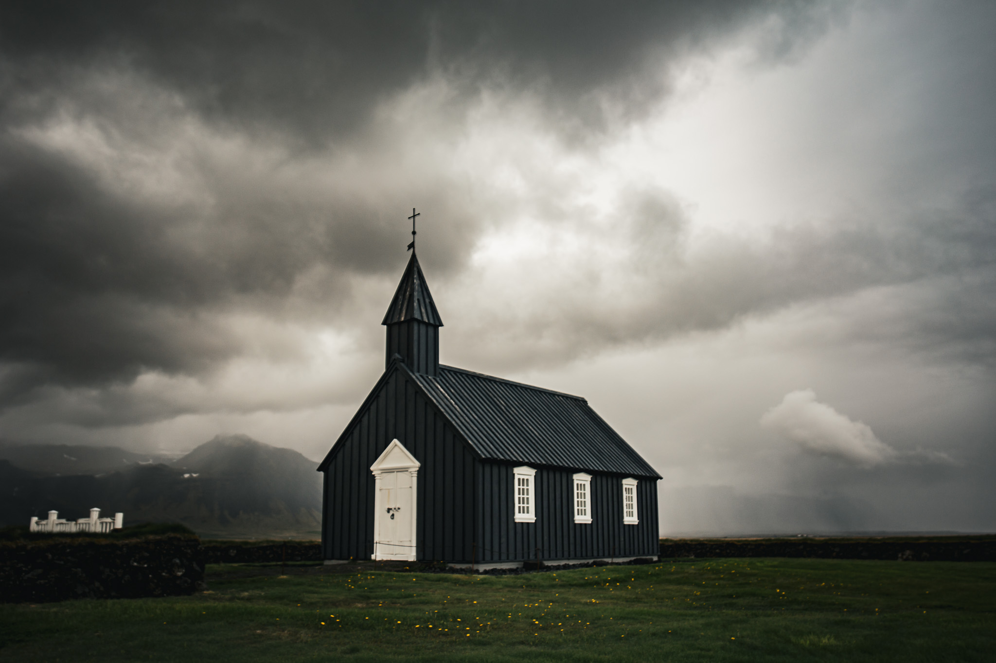
Búðakirkja. The storm was rolling in off the glacier. We had about three minutes before the rain hit.
Búðakirkja sits on a lava field on the south coast of the peninsula, with the glacier behind it and the Atlantic in front. The church dates to 1703, though the current building is a 19th-century reconstruction. What gets you is the contrast: dead black against a sky that was doing something different every thirty seconds when we were there. We arrived just ahead of a squall coming off Snæfellsjökull.
From Búðir we drove west along the south coast to Arnarstapi, a small fishing village at the base of the cliffs. The coastline here is all basalt, carved by the Atlantic into arches and caverns and sea stacks. The wind was hard, and leaning into it was fun. The rock arches at Arnarstapi are dramatic in the way that makes you realize the word dramatic is doing a lot of work.
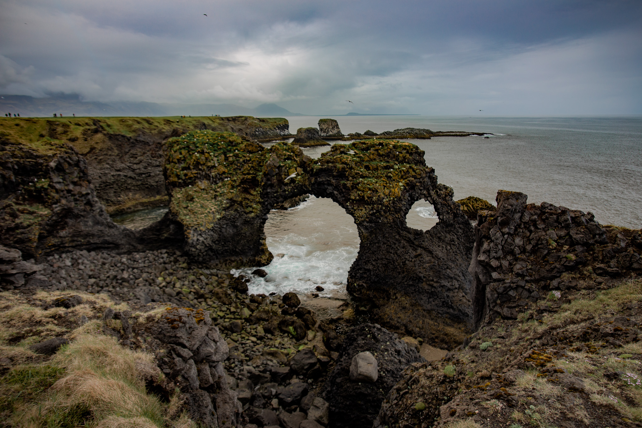
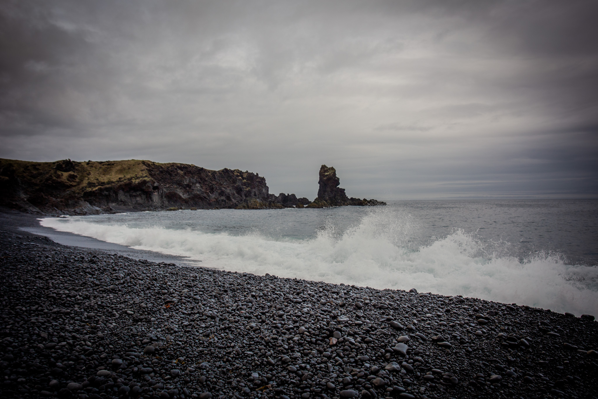
Left: The arch at Arnarstapi, carved out of the lava field by a few thousand years of Atlantic swells. Right: Djúpalónssandur, the black pebble beach, headed toward Dritvík.
Djúpalónssandur is on the north side of the glacier, tucked into the base of the cliffs. The beach is small and steep and covered in smooth black stones rounded by the surf, running down to water that is this improbable shade of dark teal. The stones are so loud in the surf, they sound like a rain stick amplified by a hundred times. There are four lifting stones there, the Kraftpróf, strength test stones that Icelandic fishermen used to assess whether a man was strong enough to work the boats. The lightest is about 50 pounds. The heaviest is 341. I moved the 50-pound one six inches and felt good about that. Scattered across the lava are the remains of a British ship that went down in 1948. The wreckage has been there ever since, and one thing I noticed about the torn metal was the absence of rivets, only rivet holes. Were these "scrapped" over time or did they disintegrate?
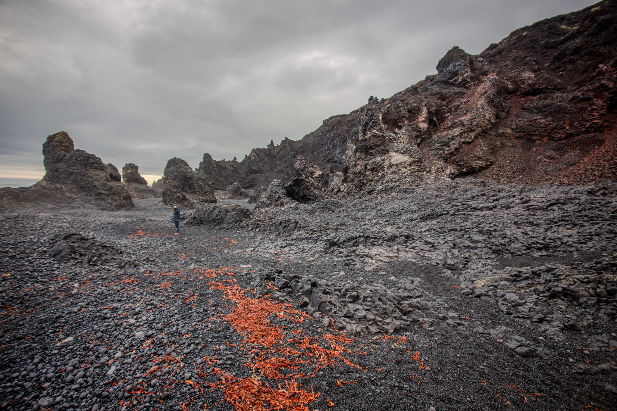
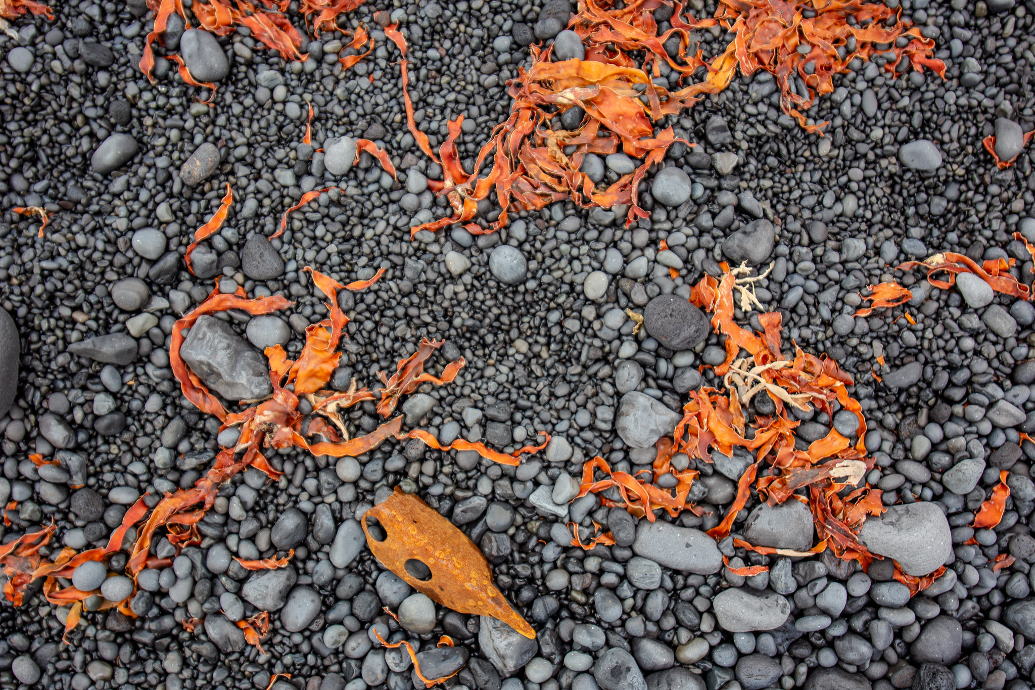
Left: The beach at Djúpalónssandur: the red is dulse seaweed washed up with the tide. The scale of the lava formations only hits when you spot the person. Right: Dulse and basalt, up close.
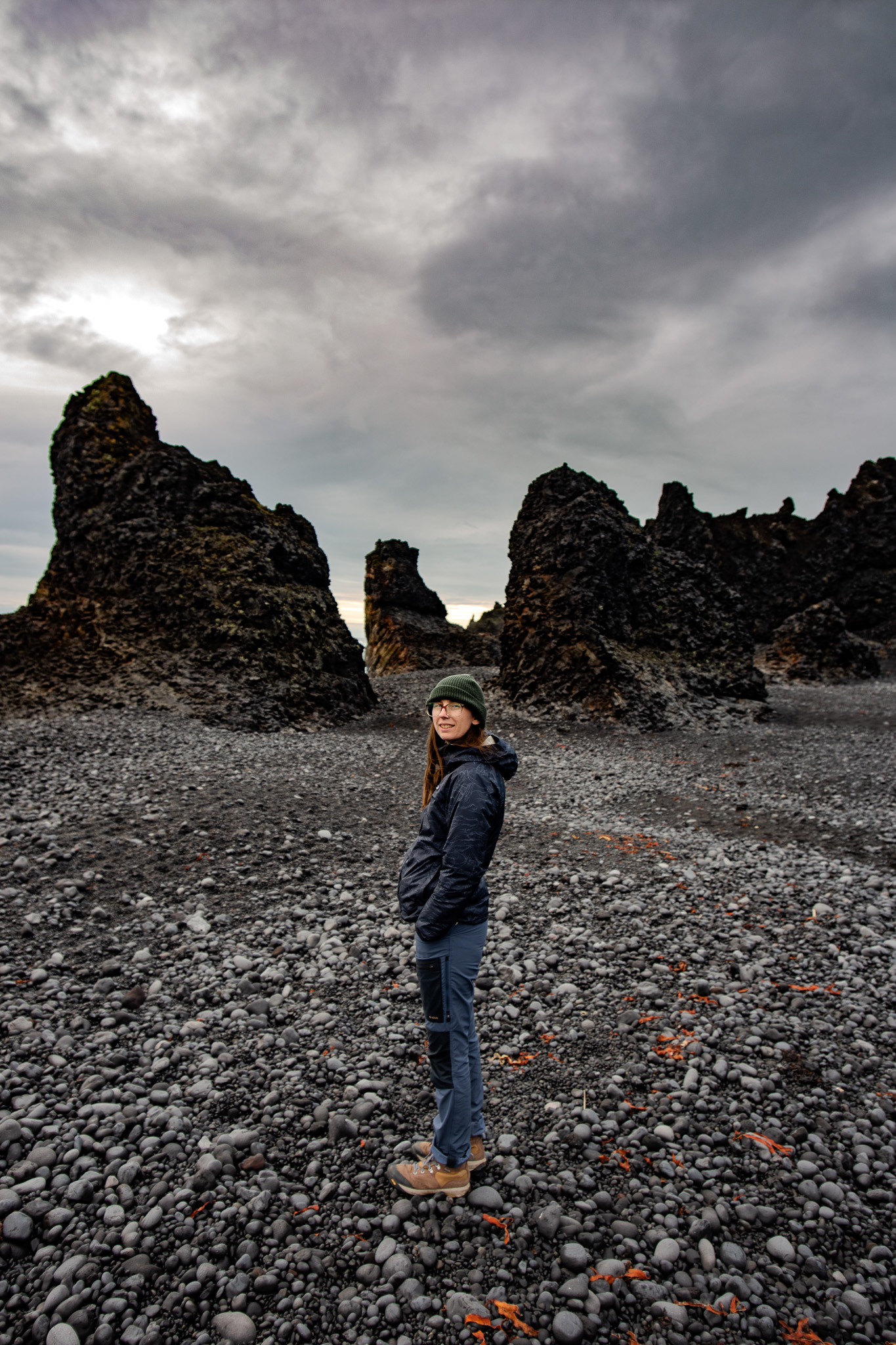
Anna between the Lóndrangar stacks. The orange traces in the foreground are the same seaweed from the beach, half a mile back.
The further west you go on Snæfellsnes, the fewer people you see. By the time you reach Svörtuloft and the lighthouse at the peninsula's western tip, you are pretty much alone. The lighthouse itself is this remarkable orange structure sitting on a cliff above the Atlantic. So many Icelandic lighthouses are orange. From up there you can see the lava shelves running down to the water, the surf crashing against basalt columns.
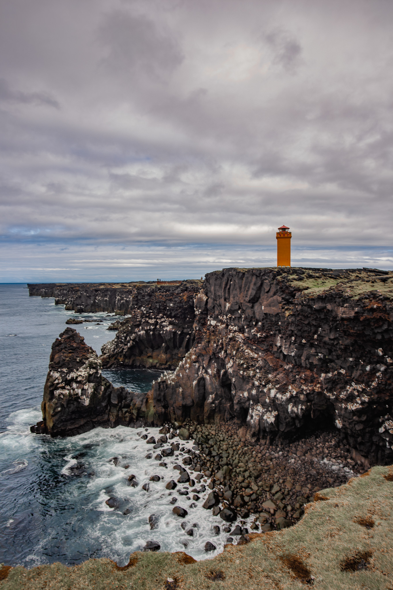
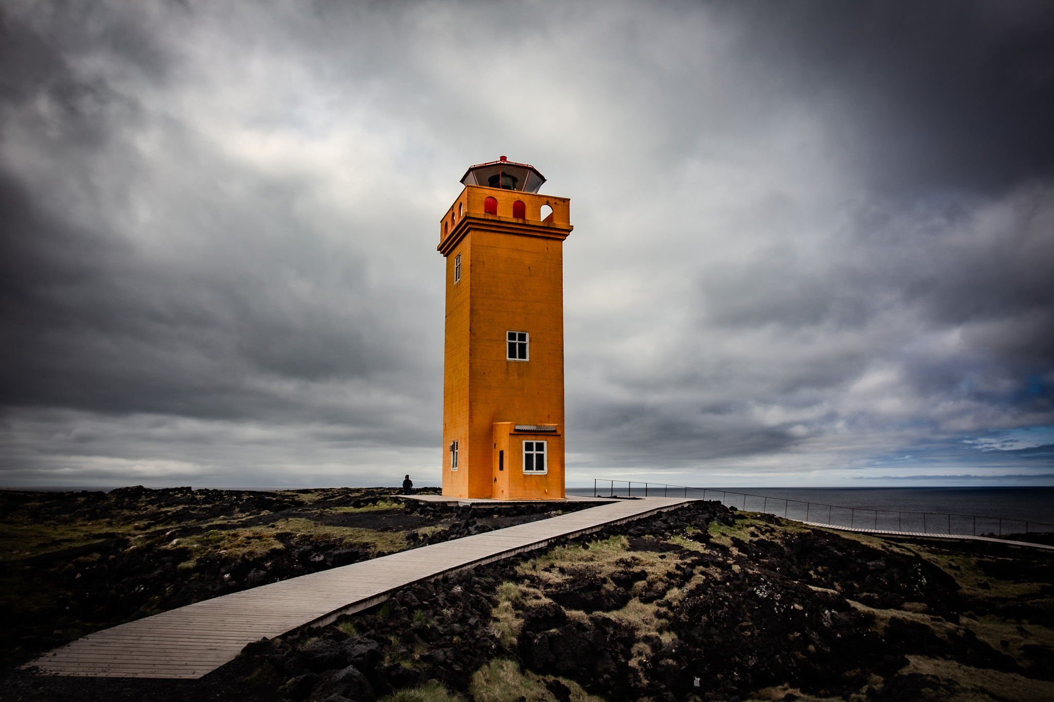
Svörtuloft. The lighthouse was built in 1931. Someone was sitting on the boardwalk, just watching the water.
We ended the Snæfellsnes section at dusk on the south coast, back near the lava fields. Long-exposure work. The surf was enormous, the Atlantic had been building swells for a thousand miles with nothing in the way. The sky went gold at the horizon while the rest of it stayed steel gray, and the waves came in fast against the black cliff face. This is one of those situations where the camera is doing something your eye cannot quite do: the long exposure smooths the motion, and what looks chaotic in real time becomes something different, especially with the colors.
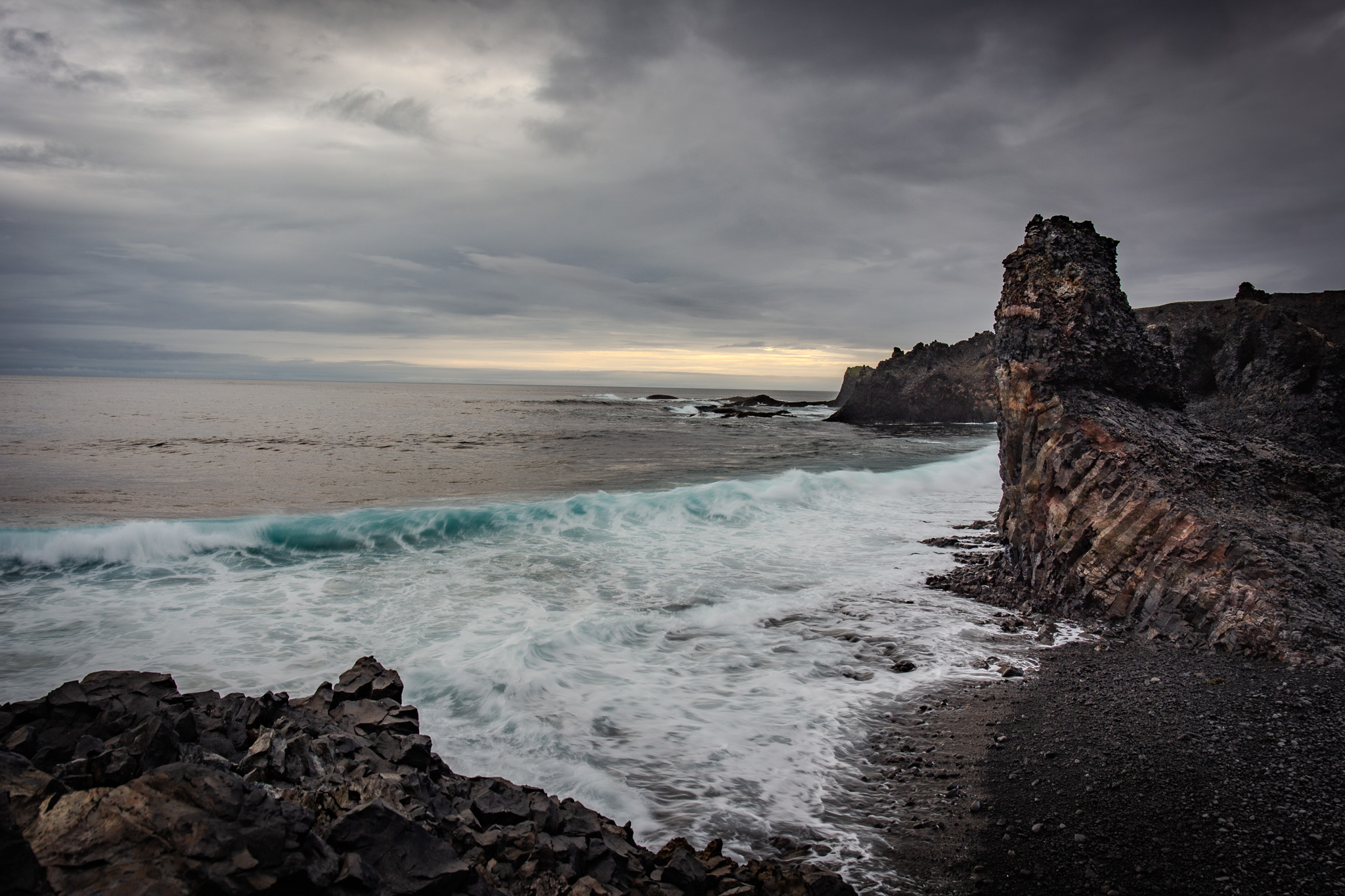
South coast near Djúpalónssandur, around 8pm. In June the sky goes this color and then just stays there for hours.
Kirkjufell
You cannot go to Snæfellsnes without stopping at Kirkjufell. This has been at the top of my millennial Iceland wish list for years. The mountain is on the north coast near the town of Grundarfjörður, and it is one of the most photographed landscapes in Iceland, which means it has been on roughly ten thousand Instagram accounts and at least three Game of Thrones promotional materials. None of that prepares you for the thing itself.
It is roughly 1,500 feet, and it rises in this perfect symmetrical cone straight out of a valley. The waterfalls at its base are called Kirkjufossar. With a long exposure you get the silken water in the foreground and the mountain perfectly framed behind it, and the whole thing looks too composed to be real. It was crowded, like so many places in Iceland in June. It did not matter. The mountain just sits there being what it is and you stand in front of it a little dumbstruck anyway.
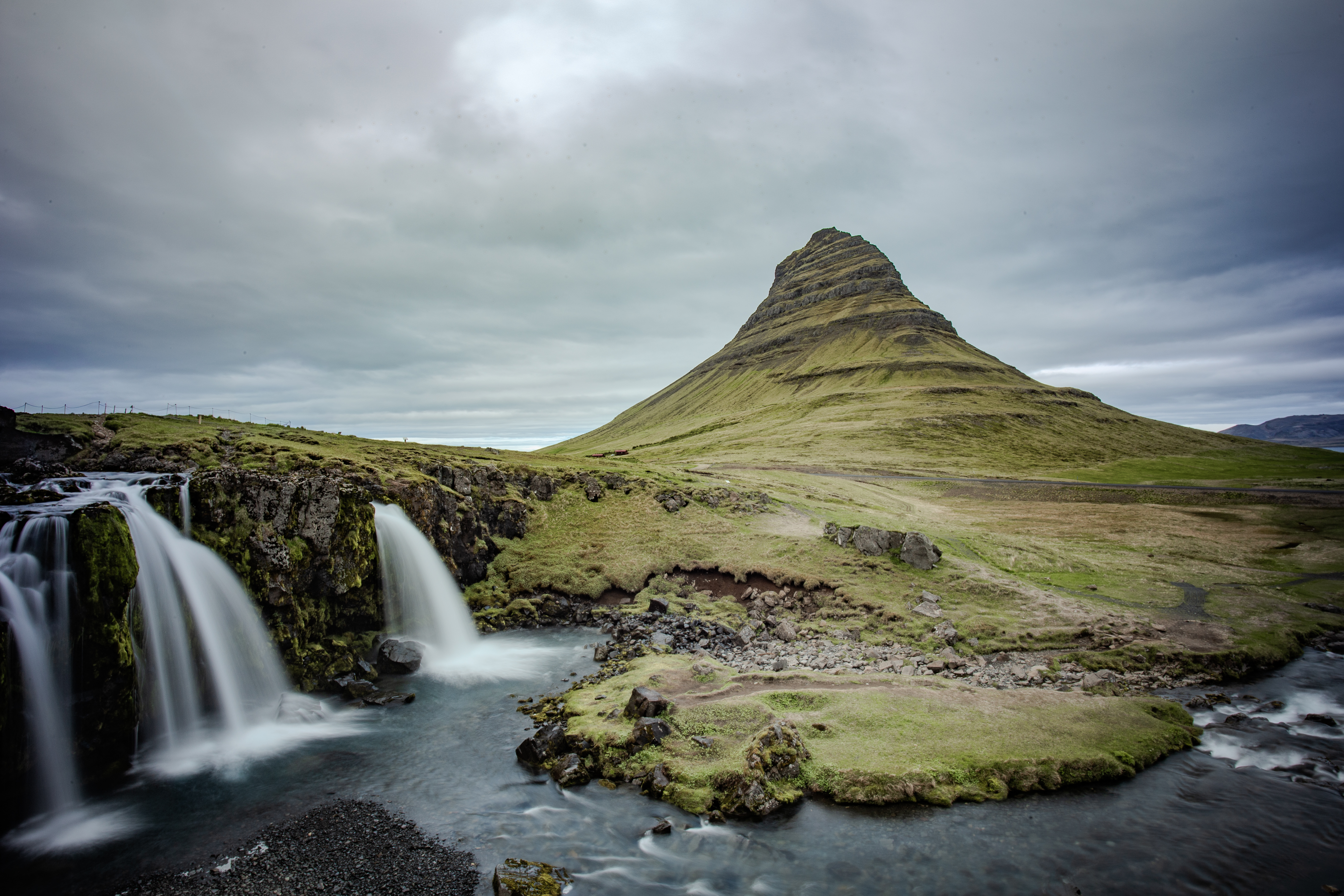
Kirkjufell and Kirkjufossar. Long exposure, 4 seconds. The mountain is 463m and comes straight out of the ground with almost no approach.
Act Two / The Westfjords
To get into the Westfjords you start at Stykkishólmur, a harbor town on the north coast of Snæfellsnes where you catch the ferry across. We expected a quiet place. Stykkishólmur looks like an Icelandic Grand Marais, a small painted town stacked above a working harbor, the kind of place where the loudest thing should be the gulls.
We rolled in to find it overrun. The town was hosting Sátan, a metal festival that takes over Stykkishólmur for three days every June. The streets were full of seven-foot Nordic metalheads in black, and every one of them we encountered was awesome. The music started at 4pm, the partyingwas more or less still going on when we left for the ferry at 7am. A festival named Sátan turned out to be one of the most joyful crowds we saw on the trip.
The ferry from Stykkishólmur to Brjánslækur takes about two and a half hours and crosses Breiðafjörður, which is full of small islands almost the entire way. The red lighthouse on Súgandisey, on the hill above the harbor, is the last thing you see going out.
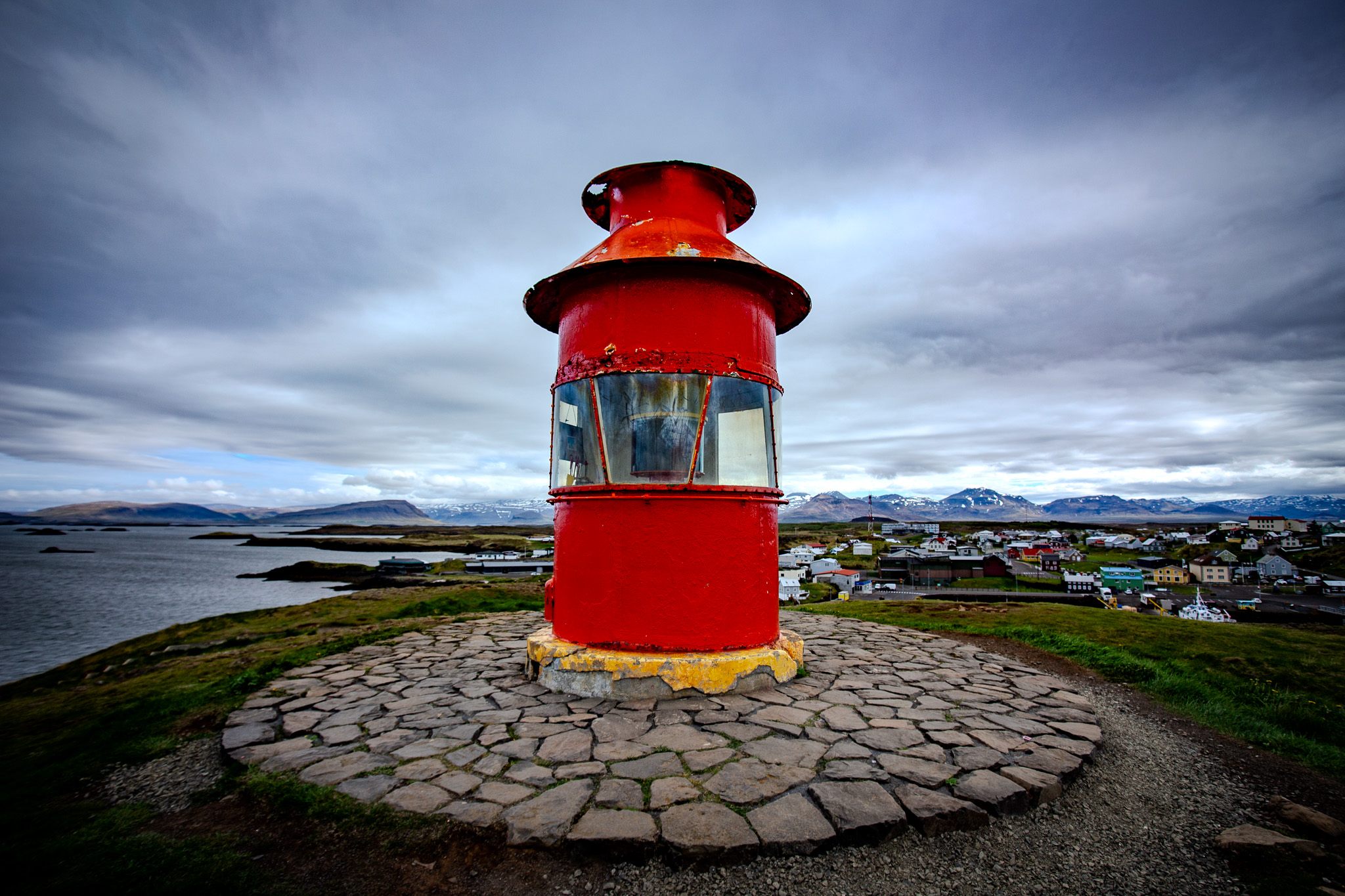
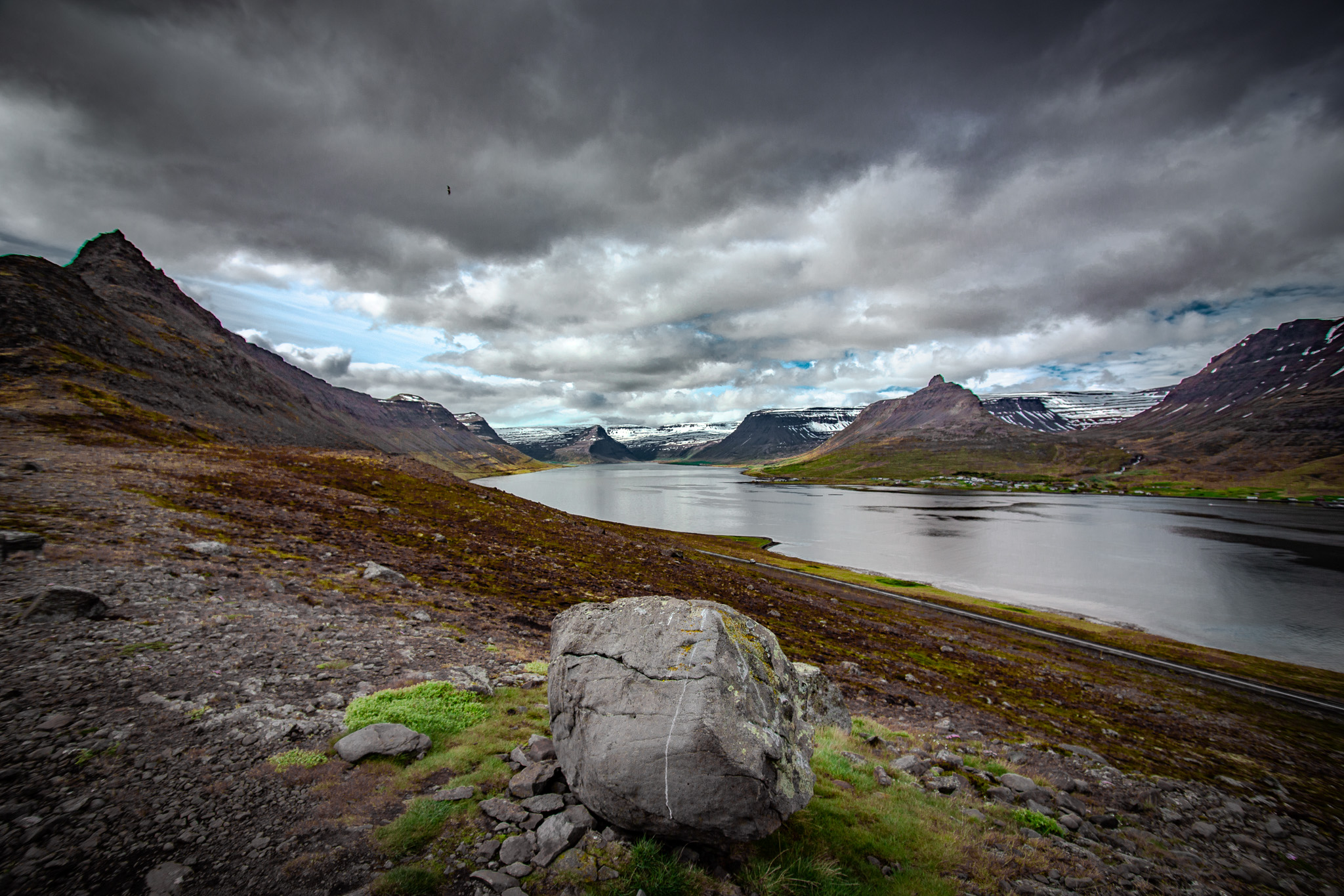
Left: Stykkishólmur from above, the red lighthouse on Súgandisey island. The town is on a small peninsula that juts into Breiðafjörður. Right: Somewhere in the Westfjords this was a pullout where we stopped because the view down the fjord was too good to keep driving past.
On the far side, the Westfjords open up, and they are the oldest part of Iceland. The fjords cut deep, and the road has to follow every inlet because there aren't many tunnels up here. A ten-mile straight line becomes a forty-mile drive along the water. You do a lot of that. You round a headland, the fjord opens up, and across the water you can see the road you'll be on in forty minutes, bending back the way you came.
Sparsely populated, the whole region has about seven thousand people, and some of these fjords have one or two farms at the end and that's it. But you're not alone on the road. We never went long without seeing another car, and after a while it was the same cars, the same handful of people working their way around the same fjords we were. You'd pass them at a waterfall, then again at a turnout an hour later, and you'd both nod like you'd known each other.
We stopped constantly. The thing about Iceland is that the beauty isn't roped off. There are unmarked waterfalls and turnouts everywhere, and as long as you respect the land and follow the rules, it's all just there for you to pull over and walk into. We pulled over for a lot of them.
Dynjandi is the signature waterfall of the Westfjords, a series of falls stepping down the cliff face in a widening fan: it's around 100 meters tall and expands from about 30 meters wide at the top to 60 at the base. The name means "thundering" in Icelandic. It earns that. When you come around the corner of the narrow gravel road leading there, it opens up in front of you, and the sound and the scale hit at the same time.
In high summer on the Ring Road you share every waterfall with a hundred tourists and a line of camper vans. At Dynjandi we had it more or less to ourselves. That's the trade you get for driving this far.
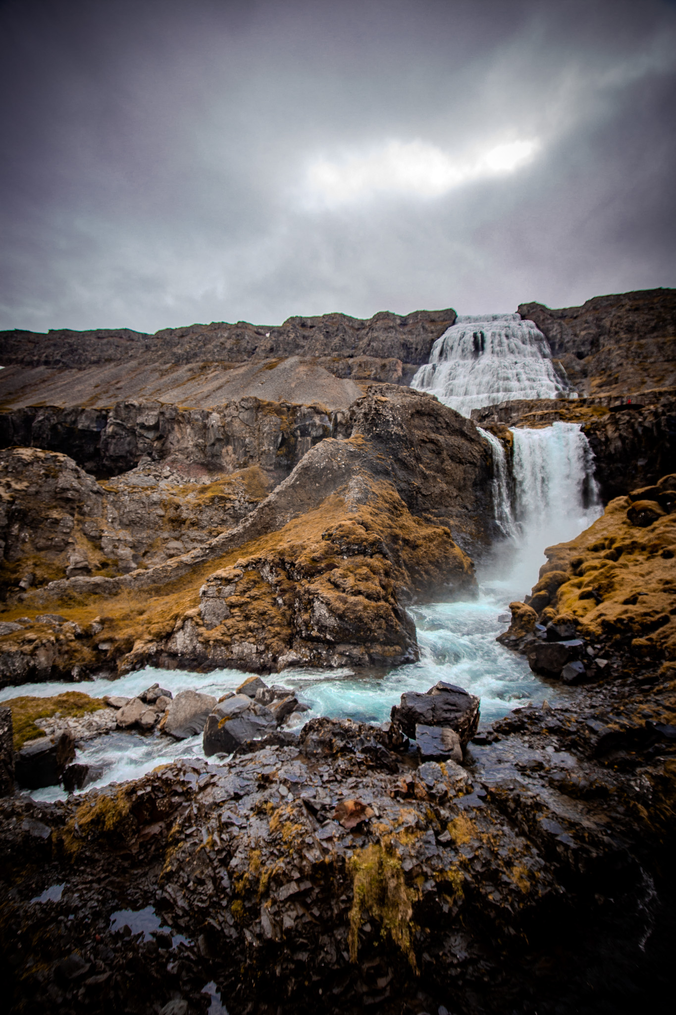
Dynjandi. The waterfall steps down in seven separate cascades. This is the second one, looking up at the main falls above.
Near the end we landed in Ísafjörður, the biggest town in the Westfjords, which means about 2,600 people and a surprising number of good restaurants. We had fish and chips at a corner store that also sold guitars and beef jerky and about everything else. Looking for the visitor center, we walked into what we thought was a tourist office and it turned out to be a birthday party, locals standing around with cake and beers, and instead of pointing us back out the door they waved us in. We stood there a few minutes looking at pamphlets while they carried on with their party.
The harbor is ringed on three sides by mountains, snow still on the upper slopes in June. There's a small airport whose runway ends at the water. The approach is supposed to be one of the hairier ones in commercial aviation, planes banking through the fjord to line up with a strip of pavement that runs right to the sea.
Down near the harbor we found a weathered signpost at a little bay, one of those old wooden direction markers with arms pointing off toward other places. The signs were long gone, the boards worn blank by wind and salt. Out in the bay a few seals were splashing around, playing with each other, completely unbothered by us. There was a small table by the water crowded with jars of homemade jam, a cash box sitting beside them. A thousand krónur a jar, about seven bucks, on the honor system, nobody watching. We left the money and took one.
It seemed right that the signs pointed nowhere in particular. By the end of eight days you could point yourself in any direction and feel like you'd find something worth the stop. Sometimes that's as big as a glacier. Sometimes it's fish and chips in a corner store that also sells guitars. Sometimes it's a jar of jam from a table by the water, no name on it, that you carry home in your checked bag and put on a PB&J in Saint Paul.
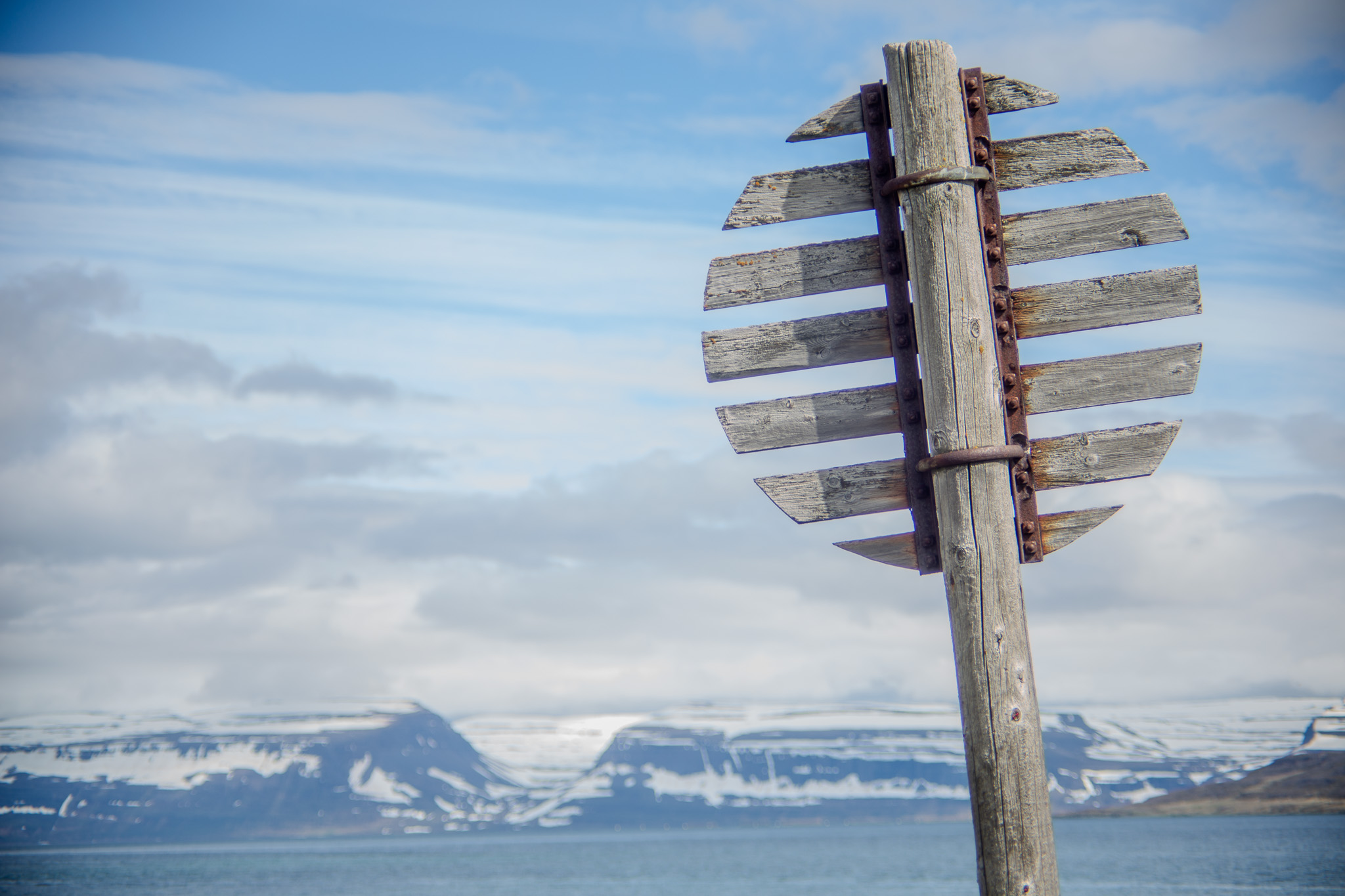
Somewhere near Ísafjörður. The signs have been blank for a long time.
All photos shot on a Canon 6D. Snæfellsnes and the Westfjords, June 2026.
Anna was a patient subject, and as always an amazing travel partner.
Print inquiries: wendigophoto.pixieset.com
Leave a Comment